Survey marks are reference points used to define property boundaries and support surveying, infrastructure and construction activities across South Australia. Many are found in road reserves, footpaths and other work sites, with some located underground or not easily visible.
If survey marks are damaged or disturbed, it becomes difficult and costly to re‑establish property boundaries, which can lead to delays and increased project costs. By planning, you can avoid these impacts and save that survey mark.
Before commencing any ground-disturbing work, check for survey marks by using the South Australian Property and Planning Atlas (SAPPA).
Quicks steps to check for survey marks:
- Open SAPPA – the South Australian Property and Planning Atlas.
- Use the search bar to enter the address or zoom to your area of interest.
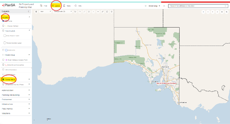
- At the top of the page, select the Layers icon.
- In the left‑hand menu, select Location.
- Tick the checkbox for Survey Marks to display them on the map. (Please note that you may need to zoom in further for the survey marks to appear).
- Ignore any blue diamond or red symbols – these marks do not require preservation.